Chucunaque Fm
Type Locality and Naming
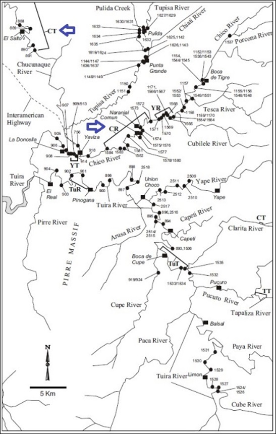
Coates et al. (2004) propose as stratotype the sequence on the Chucunaque River from south of El Salto to above Caleta on the Tuquesa River (CT on Figure 2 & Figure 3). A reference section is located on the Chico River (CR on Figure 2).
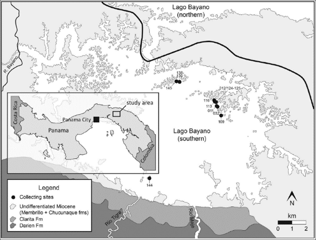
[Figure 1. Map of Lago Bayano, Panama with collecting sites denoted by black circles. Numbers labelling each collecting site refer to the last three digits of the Smithsonian Tropical Research Institute (STRI) field number. Perez et al. (2017).]
Synonym: Chuqunaque Fm (misspelling); Chucunaque River Fm
Lithology and Thickness
The Chucunaque Fm was deposited at an inner neritic depth around the Chico River valley region, and at upper bathyal depths in deeper portions of the Basin (Membrillo River section). It commonly contains oxygen-deficient assemblages. In the Membrillo River and Chucunaque River sections, samples contain characteristic upper bathyal taxa.
In the southeastern-most portion of Lago Bayano (Figure 1), exposed uneroded blocks comprise strongly weathered and sparsely fossiliferous orange mudstone. The islands in the northern portion of southern Lago Bayano contain a more varied range of facies, including fossiliferous, gritty orange sandstone and a fine-grained tuffaceous white sandstone.
Thickness: The thickness of the Chucunaque Fm is not less than 400m in the northwest and not less than about 1200m in the center of the Chucunaque-Tuira Basin.
[Figure 2. Stratotype (CT marked by blue arrow) of the Chucunaque Fm (see continuation on Figure 067). Coates et al. (2004).]
[Figure 3. Reference Section (CR) and continuation of the Chucunaque stratotype (CT) (Figure 066). Coates et al. (2004).]
Relationships and Distribution
Lower contact
Upper contact
Regional extent
GeoJSON
Fossils
Age
Depositional setting
Additional Information
- Terry (1956) used the name again without defining it.
- Wilson et al. (1957), Woodring (1960), Coates et al. (2004); Perez et al. (2015 & 2017).


